

How to Hike Seward Mountain and Range in the Adirondack Mountains, New York
Adirondack 46er High Peak Challenge

Seward Mountain and the whole range are apart of the Adirondack 46er High Peak Challenge in upstate New York. This range is one of, if not the most remote ranges within the whole challenge. It is past Lake Placid and Tupper Lake, on a SEASONAL ROAD, Coreys Road. Again, this is a seasonal road, meaning in the winter (late October until late May), this road is closed. If you want to hike Seward Mountain and the whole range in the winter, you will have to park 3 miles further, from the actual trailhead for these peaks.
Most of the other peaks in this challenge, are located in Keene Valley or Lake Placid, New York. However, this range is about 27 miles southwest of Lake Placid (about 45 minutes away from Lake Placid) near Tupper Lake, NY. There are a total of 4 high peaks in this range, with a total elevation gain of almost 6,000ft. Most people hike Seward, Donaldson and Emmons together (this is what I did), and Seymour on its own. You definitely can hike all of them together, but beware, it will be about a 22-25 mile day.
In this article, you will read about Seward Mountain, Seward Range hike, Seward Mountain Adirondacks, Seward Mountain trailhead, Seward Mountain NY, Seward Mountain hike, Seward Range via Calkins Brook, Mountain parking area, the Seward Range loop, Seward Range Adirondacks, Seward, Donaldson, Emmons, Seymour, backpacking the Seward Range, and more.
This article is all about the Seward Range.
Seward Mountain Trailhead
To get to this range you will get on Interstate 87 North (coming from Albany). You will get on Interstate 87 South if coming from Plattsburgh or north if coming from Albany and the capital region. Stay on 87 until Exit 30. You will take Exit 30 towards Keene Valley, Lake Placid, and Whiteface from the highway. You will take a left from the exit onto Route 73 or a right if coming from Plattsburgh. In about 2.3 miles you will come to a funky intersection, that you want to stay left towards Whiteface and Keene Valley.
For 13 miles continue straight. You will come to an intersection at the end of Keene, where you want to continue right, towards the High Peaks. There will be a small sign for it, so you should see it. In another 13 miles, you will keep left onto Old Military Road, then in 3.6 miles you will take a slight left onto NY-86. In 2.4 miles you will again, keep left onto NY-86 and in 3.7 miles you will take a left onto River Street. Continue onto River Street in .3 of a mile and in .2 of a mile you will continue onto NY-3.
In 13 miles you will take a left onto Coreys Road, then another left in 500 feet onto Coreys Road. Then in 5.5 miles the parking lot will be on your right. The last 3 miles of this road is a seasonal road, and is only open from Memorial Day (late May) through late October/November. Thus, if you plan on getting your winter 46er, remember that you will have to add an additional 6 miles total to your trip. Here you can find exact directions.


Backpacking Seward Range
The first way people usually hike up these peaks is by hiking towards the Ward Brook Lean-To. If you want to hike Seymour too, I recommend hiking towards the Ward Brook Lean-To. Then, hiking Seymour first, then the rest of the peaks. Seymour is the farthest out of the way, thus it makes sense to do it first. Also, the trail going to Seymour is pretty steep, thus it’s better to go up than down. You could camp at the Ward Brook Lean-To then hike the rest of the range the next day, which will take off about 5 miles of your trip, making it a 16 mile day instead of a 22.
Seward Range Map & Seward Range via Calkins Brook
Now, if you’re going to just hike Donaldson, Emmons and Seward in one day then Seymour another day, I recommend taking the Calkins Brook Trail (only for Donaldson, Emmons, and Seward). This is a less strenuous and less steep approach. On the Calkins Brook trail, you will first hike to Seward, then Donaldson, then finally to Emmons. This is what myself and my hiking group did when we hiked this range. We hiked Seward, Donaldson, and Emmons together, in that order. Then we hiked Seymour separately, on its own.
Again, hiking just the three peaks, I suggest taking the Calkins Brook Trail instead of the steeper trail to Seymour, passed the Ward Brook Lean-To. From the parking lot and the trail registration, you follow the Blueberry Trail. There will be a split about a mile and a half in, where you want to continue onto the Blueberry horse trail. Then in about a mile or so, there will be another spilt with a rock cairn in the middle. You want to go left, do not go right and follow the yellow trail markers, continue left onto the unmarked trail.
Then shortly after, you will come upon the Calkin’s Brook, where you again, will see more rock cairns. Follow the rock cairns, as they will show you were to cross the brook, and where to pick the trail back up on the other side. From there, you will continue on the Calkins Brook Trail for about 2.6-3 miles. Then right before Donaldson, you will see another rock cairn indicating the split between Seward and Donaldson.


{Related Post : How to Hike Haystack, Basin, and Saddleback}
Getting to Seward Mountain
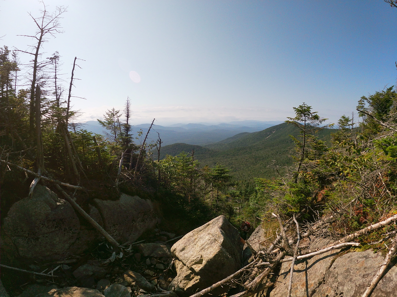
This split is about .2 miles away from the summit of Donaldsons. I know it’s tempting, but I suggest not hiking Donaldson first. Instead, I suggest going left towards Seward first. Seward will be the most strenuous peak to hike to, apart from hiking the Calkins Brook Trail up. Seward is about 1.1 miles away from Donaldson. It will be a lot of up and down. There are a couple of steep rock climbs, but they are all very manageable.
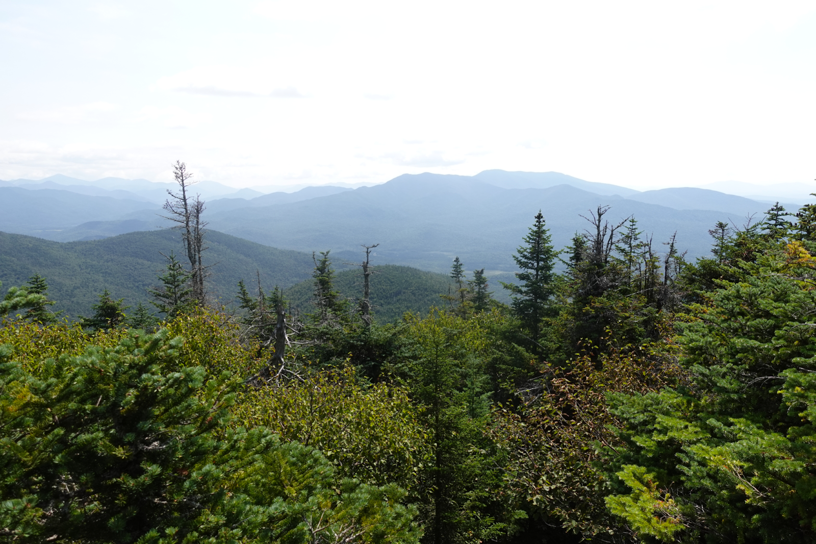
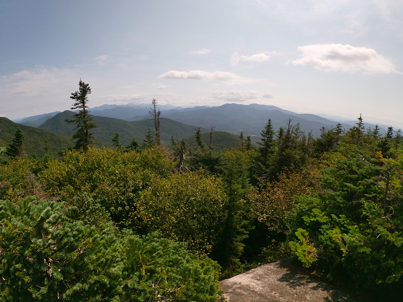
Once you get to the top, there will be a summit plaque at the top of Seward. It is a wooded summit, but there are some pretty cool views on your way to the top. After Seward, I would finally hike to Donaldson. To get to Donaldson, you will just retrace your steps back to the cairn of rocks that splits Donaldson and Seward. Once you get to the cairn of rocks, you will continue left/straight from the cairn of rocks to Donaldson.


{Related Article : How to Hike the Santanoni Range}
Continuing to Emmons Peak
Again, there are some steep rock scrambles getting to Emmons, but you should be fine. Donaldson has the best view, in my opinion. There is no summit sign, but there is a nice little rock lookout. From here, you will continue straight to Emmons. Beware, there is A LOT of mud on this part of the trail. I know almost all the Adirondack High Peaks have A LOT of mud, but this trail is ESPECIALLY muddy. There is one specific bog that is caked in mud, and literally has no way around it.
It is about a mile hike to Emmons. It is a relatively flat mile. The little elevation you lose, you will gain right back up when nearing the summit. There will be a summit plaque, and a little bit of a view on Emmons. Again, there are some tricky rock scrambles, but nothing too bad.
Getting Back Down
To get back down, you will retrace your steps back to Donaldson and get to that rock cairn splitting Seward and Donaldson. You will continue straight onto the Calkins Brook Trail and follow the same way up, as down. In total this loop is about 16 miles, even though my phone said 17.5 miles. This range is definitely not as bad as some of the others, but still has a good workout. However, if you include Seymour into this loop, it adds about 4 extra miles, making this loop about a 21.5 mile loop. Which again is totally doable, but just a very long day. And instead of hiking the Calkins Brook Trail, you will hike to the Ward Brook Lean-To.
Hiking Seymour As An Out and Back
To hike Seymour on its own, you will start from the parking lot (same one as the the other three peaks), following the signs to the Ward Brook Lean-To. About 1.2 miles in, you’ll reach a split, where you will want to continue straight towards the Ward Brook Lean-To. After this, it is about 3.6 miles to the Lean-To. About half way, you will start to follow a narrow/swampy path, when you emerge from it, there will be another split. You can either go left towards a red marked trail, or right, to an unmarked trail. You want to continue right to the unmarked trail and into the woods.
Rock Cairn Trailhead
After you reach the Ward Brook lean-to, about a tenth of a mile passed the lean-to, you will find a rock cairn, where you will turn left onto, and follow an unmarked trail up to Seymour Peak. It becomes VERY steep after this cairn, and VERY difficult to follow. Thus, I recommend looking at your AllTrails a lot or map, because it is easy to get off track and lost. I did hike this during the fall when the leaves were everywhere. Thus, all the leaves on the trail made it difficult to see the actual trail. In the summer I would think it’s much easier to make out the trail because there’s no leaves in the way.
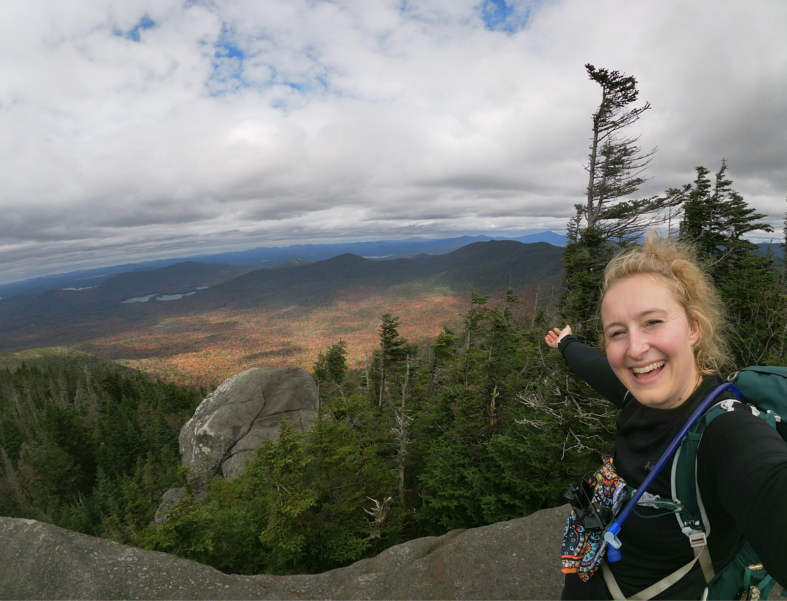
This last for about 1.5 miles then you will get to the top of Seymour. Seymour does have a summit plaque, and about .3 of a mile before the summit it does flatten out, and there is a lookout viewpoint. You can take some nice pictures at the viewpoint if you wish. If Seymour is the only mountain you’re hiking that day (which is what I did, and the other three peaks another day), then you can come back down the way you came up.
{Related Post: How to Hike Gothics and the Lower Great Range}
Seward Range in a Day, Seward Range Loop
Alternatively, if you wish to complete the entire range in one day, you will hike back to the Ward Brook Lean-To. And from there you will follow the herd path to Seward, then Donaldson, and then Emmons. After Emmons, you will come back down past the summit of Donaldson (about .2 of a mile) where you find another rock cairn. You will continue straight, past the rock cairn and continue to follow the Calkins Brook Trail and the Blueberry Horse Trail into Blueberry Trail, back down to the parking lot. You could also camp at one of the campsites or lean-tos here to make your journey less mileage as well in one day.
And that wraps this article about the Seward Range. I hope this helps and you get out on your next adventure soon. Also, here is the AllTrails map I followed for the 3 peaks, here is the one I followed for Seymour, and here is one for the whole range. Thank you so much for reading and take care!

