

How to Hike Mount Redfield & Cliff High Peaks in the Adirondacks

If you are familiar with the Adirondack 46ers, then you will know, Mount Redfield is one of the famous 46ers. It is typically paired with Cliff Mountain, which I recommend. Now, Allen, Redfield, and Cliff Mountains are all said to be the toughest peaks out of all the 46ers. In addition to, Blake and Couchsachraga, they are also said to be the least favorite and toughest 46ers. After climbing all five of these mountains, I can honestly say, I did not like Redfield and Cliff. They were definitely my least 46ers to hike.
I would re-hike Allen Mountain any day before I hiked Cliff and Redfield again. Solely, because there was only one mountain to climb instead of two. I’m really not a fan of Mount Redfield and Cliff, however, knowing how to hike them is CRUCIAL, especially if you want to be a 46er. They are TRICKY hikes, in my opinion and I really only recommend hiking them if you want to be a 46er.
Therefore, in this post we will talk about hiking Mount Redfield and Cliff, Mount Redfield NY, Mount Redfield trail, Mount Redfield Adirondacks, Mount Redfield Cliff, Mount Redfield hike, Cliff and Redfield from Loj, Cliff Mountain, Cliff Mountain ADK, and more.
This post is all about Cliff and Redfield.
Cliff and Redfield:
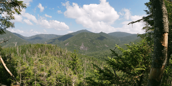
Cliff and Redfield from Upper Works


{Related Post : Slide Mountain, Catskills}
Getting to Cliff and Redfield Parking
There are two main ways to complete the Cliff and Redfield hike. You can either hike them via Upper Works and the Calamity Brook Trail or via the Adirondack Lodge. My friend and I hiked them via the Adirondack Lodge. However, it is more straight forward to hike them from Upper Works and Calamity Brook, which is what I will discuss right now. Also, if you want to get a third peak in, you can add on Mount Marshall this way too. However, if you are going to hike Mount Marshall as well, I would camp at Upper Works.
To get to Upper Works and the Calamity Brook Trail, you will take Exit 26 towards Potterville (from Interstate 87 North), and take a left onto US-9 from the exit (you will take a right if coming southbound on Interstate 87). In .4 of a mile take a right onto US-9. Then, in .2 of a mile, you will take a slight left onto Olmstedville Road, and stay straight for 4.9 miles. In 1.1. miles, you will stay left onto CR-29, then in .4 of a mile, take a right onto Morse Memorial Highway.
Then, in .3 miles, keep left onto A P Morse Memorial Highway, in 2.6 miles, you will take a slight right onto NY-28N, then in 14 miles, take a right onto Blue Ridge Road. In 1.2 miles take a left onto CR-25, then in .4 of a mile, keep left onto CR-25. Then in 5.9 miles take a left onto CR-25, then in 3.5 miles, your destination will be on your right. You will see signs for Mount Adam’s Fire Tower and Upper Works parking area. This is also for Cliff and Redfield parking and where you want to park.


{Related Post: How to Hike Mount Marshall}
Hiking Cliff and Redfield from Upper Works via Calamity Brook Trail
Once you’ve parked, you will go to the trail register book for Mount Adam’s Fire Tower. Then you will follow the signs towards the Flowed Lands for about 4.4 miles. This trail is also called the Calamity Brook Trail. Then, you will follow the Flowed Lands Trail (Calamity Brook Trail) towards Colden Dam. Eventually, you will see rock cairns on your right for Mount Marshall.
Adding Mount Marshall in addition to Mount Redfield and Cliff, will add about 3 more miles to your trip, and 2,000ft more of elevation gain. Also, your day will be a 21-23 mile day instead of 17-19 mile day. So, I advise camping here if you wish to add on Mount Marshall. You can hike Cliff and Redfield in one day, then camp/sleep for the night. Then wake up and hike Mount Marshall the next day.
Cliff and Redfield Camping
Some places to camp on the Calamity Brook Trail are the Uphill Brook Lean-To, which is pretty close to the herd paths for Mount Redfield and Cliff. Also, if you want to hike Mount Redfield, Cliff, and maybe Marshall from the Lodge, you could always camp at the Colden Lake Campgrounds (near Marcy Dam) and at or near the Feldspar Lean-To (on your way to Lake Tear of the Clouds).
Cliff and Redfield Hike via Upper Works & Calamity Brook Trail
Okay, going back to Cliff and Redfield, after you pass rock cairns for the Mount Marshall herd path, you will then see the Uphill Brook Lean-To and signs for it (you can also camp/backpack here). You will walk pass this sign, and you will see a cairn of rocks on your right. This is a VERY short distance, you will also see a Dig It sign. This sign indicates where you need to turn, there will be a M for Marcy and R for Redfield with arrows underneath informing you where to turn.
This is the same rock cairn and Dig It sign that you will see via the Adk (Adirondack) Lodge. You will follow the same directions as the Adirondack Lodge from here. To hike back down, you will follow the same way down as you went up. Here is a link to the AllTrails Map, which I HIGHLY recommend using for your hike. You will have to download the map before you hike and have a pro account to be able to use the offline version of the map.


{Related Post : Seward Mountain Range}
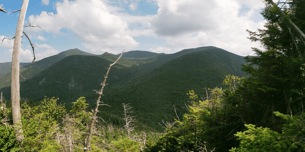
Cliff and Redfield from the Adk (Adirondack) Lodge
This is how I hiked Mount Redfield and Cliff. I wish I could compare it to the Calamity Brook Trail, but I’ve never hiked these peaks via Upper Works (the Calamity Brook Trail). And to be honest, I never want to hike these two peaks again. But from the trail maps I have read, it seems more straight forward and 1-3 miles shorter via Upper Works than via the Adk Lodge. I will explain to you right now the exact route I took and if it sounds like a better trip than the Calamity Brook Trail to you, then go for it. Truly, you’ll just be happy when these two 46ers are finished.
That being said, to get to the Adirondack Lodge, you will start on Interstate 87 North or South, depending if you are north or south of Exit 30. You will stay on here until Exit 30, then take the exit and take a left onto to Route 73 (you will take a right if you are coming southbound). In about 2.3 miles you will come to a funky intersection, that you want to stay left towards Whiteface and Keene Valley.
Getting to Loj Road
For 13 miles continue straight. You will come to an intersection at the end of Keene, where you want to continue left, towards the High Peaks. There will be a small sign for it, so you should see it. After, you will continue straight for 11 miles, then take a left onto Adirondack Loj Road. You will stay on this road for 2.5 miles. Then come upon the Adirondack Lodge. There will be an attendant window, where you will have to pay $15 for parking. However, you can stay the night here, at the Adk Lodge. There are also plenty of places throughout the Adk Lodge that you can camp/backpack overnight at.
You will have to pay $15 to park at the lodge if you are not a member. If the attendant is not at the window, you will need exact change. Also, you will open the box under the window, and you will have to put your money in the envelope and fill it out. Then, you place the envelope into another box beside it (there are instructions there of what to do). After you have parked, you want to walk towards the first parking lot, to the trail register/trailhead for Mount Marcy.


{Related Post: Panther Mountain}
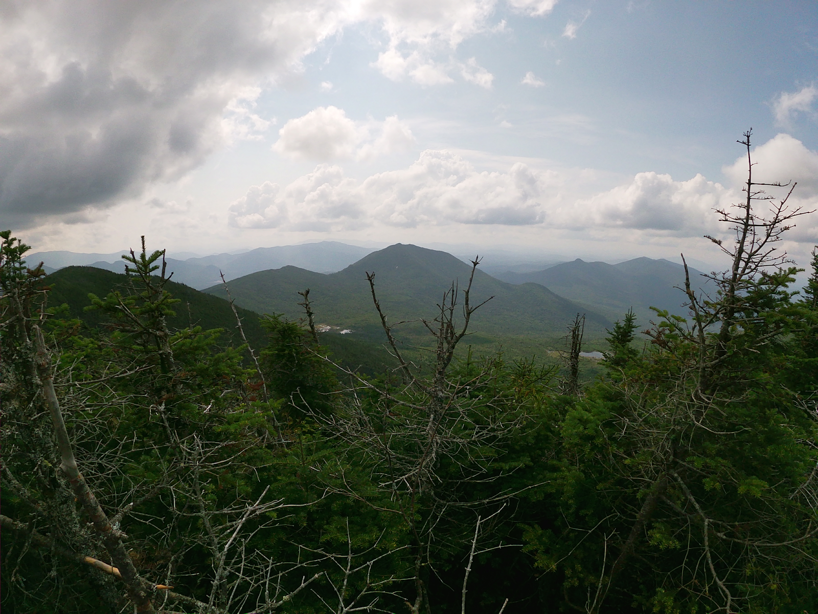
Mount Redfield and Cliff
You can sign in at the trail registration, then head towards your left and follow the signs to Marcy Dam. You will get there in about 2.4 miles. Then you will hike to the Avalanche Camps. This will take about a mile or so, then you will see signs for Lake Arnold, that you want to follow. There will be a sign for Indian Falls, ignore this, and follow the sign towards Lake Arnold.
After about 2.6 miles, you will see signs for Lake Arnold and Mount Colden to your right. You don’t want to follow this, you want to continue straight. If you want to see Lake Arnold, you can follow the sign on your right towards Lake Arnold and Mount Colden. Lake Arnold is no more than 1/2 a mile away.
After Lake Arnold, or if you continue straight, you will start to make your way to the Feldspar Lean-To. This will take about 2-2.6 miles. Then you will come to the Lake Tear of the Clouds junction, where you want to turn RIGHT. DO NOT go towards lake tear of clouds, this will bring you to Gray, Skylight, and Marcy, NOT Redfield and Cliff.
Hiking to the Uphill Brooke Lean-To
From here, you want to hike to the Uphill Brook Lean-To, which will be about a mile. Be CAREFUL here, because right BEFORE the signs for the Lean-To, is the cairn of rocks, that you want to turn left onto, to get to the other cairn of rocks, indicating the trail split for the different herd paths for Redfield and Cliff.
There will be a Dig It sign with LIGHT engravings on it. There will be an M for Marcy with an arrow pointing to your left and then another arrow pointing to your right with Red above it for Mount Redfield. It is VERY important to turn here, because if you continue straight, you will be on the Calamity Brook Trail. The Calamity Brook Trail will eventually bring you back to the Upper Works parking lot, and NOT the Adk Lodge.


{Related Post : How to Hike Gothics & the Lower/Entire Great Range}
To get to the Dig It sign, you will hike .1 of a mile, then follow the arrow, and go to your right. You will see more rock cairns, indicating the start of the herd paths for Mount Redfield and Cliff. Redfield is to your left/straight, while Cliff is to your right. My friend and I hiked Redfield first because it’s longer and has a higher elevation gain, which I recommend doing. Redfield is about 1.5 miles away with an elevation gain of about 1,500ft. This herd path FEELS SOOO LONG, it is UP the ENTIRE way. Mount Redfield has a small summit with a Mount Redfield summit plaque.
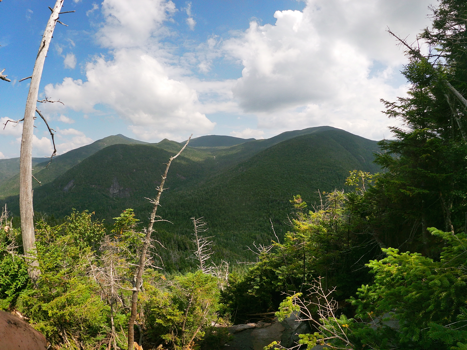
Hiking Cliff Mountain
After Mount Redfield, you will hike back down to the cairn of rocks, and go towards your left to Cliff Mountain. As it lives up to its name, Cliff, is FULL of Cliffs. I’d advised for shorter people (like myself) to bring a taller person along, at least 5’7″ or taller. There was one cliff that I was sprawled out on because I could not find anywhere to pull myself up on.
So, my friend literally had to drag me up until I could find a place to grab onto and eventually pull myself up. Cliff is about .9 miles away from the rock cairn and has an elevation gain of about 800ft. Cliff does increase in elevation gain, then it’ll go back down, then up very shortly to reach the summit. Again, you will know you’re at the top by the summit plaque. It’s a wooded summit but when climbing the cliffs, you will see views after each one of the cliffs you go up.
To get back down, you will follow the same way down as you went up. Again, just make sure you follow your landmarks, because it’s very EASY to get lost on this trail. It’s not nearly as straight forward as other hikes are. You could also download the AllTrails Map (have to have pro, to use the offline maps), and bring a physical map of the area with you, which I HIGHLY recommend. I did this and it REALLY helped me and my friend.


{Related Post : How to Hike Mount Colden & All You Need to Know About Whiteface Mountain}
Overall Thoughts of Cliff and Redfield
And that wraps up our trail report for Mount Redfield and Cliff. To be honest, I am VERY happy these two peaks are done. I am not a fan, in my opinion, they were WAY too much work for little payoff. Meaning, I didn’t think the views were that impressive for how much I hiked. They did have views, but I was expecting SO MUCH more from a 20-22 mile day.
I will say, the views are definitely better than Blake and Couchsachraga, but again, WAY too much hiking for the summits. I ONLY recommend hiking these two mountains if you are trying to complete your 46, otherwise, don’t torture yourself with this hike. Anyways, thank you so much for reading, take care, and get exploring!


One Comment
Pingback: